Contact us:
Dr. Zifei Liu

Assistant Professor
Biological & Agricultural Engineering
Kansas State University
043 Seaton Hall
Manhattan, KS 66506
Email: Zifeiliu@ksu.edu
Phone: 785-532-3587
Fax: 785-532-5825
Smoke management practices
Smoke management practices that address air quality concerns
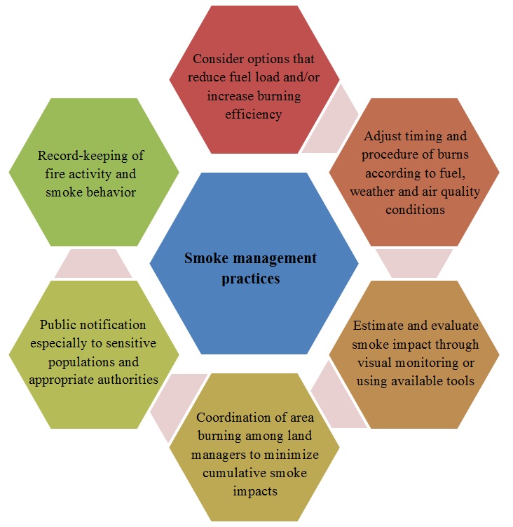
Smoke management practices are summarized in the following Figure to offer a suite of recommendations that land managers can follow to address air quality concerns of smoke from prescribed pasture burning. Before the burn, land managers should identify the burn objectives; make proper plans and notify appropriate authorities, neighbors and those potentially impacted by smoke, especially sensitive receptors. During the burn day, it is important to monitor and retain information about the weather, burn and smoke. If air quality problems occur, documentation helps analyze and address air regulatory issues. After the burn, an evaluation of the success and impact of the burn is recommended.

(Adapted from NRCS Basic Smoke Management Practices, 2011)
The State of Kansas Flint Hills Smoke Management Plan
Enforcement of existing regulations on agricultural burning is primarily handled by local fire and emergency management personnel with primarily concerns on safety issues. However, the integration of smoke management efforts into fire management decisions becomes increasingly greater. With improved understanding of the social dimension of prescribed pasture burning, land managers can continue burning practices under collaboratively designed risk scenarios that are supported or at least understood by stakeholders. As a result of the continued exceedances of the ozone standard, in 2010, Kansas Department of Health and Environment (KDHE) published a smoke management plan which describes practices to reduce air quality impacts of prescribed pasture burning in the Flint Hills. Evaluation of the plan is ongoing with input from all stakeholders, including land managers, EPA, and environmental groups. The majority of this plan is voluntary. A data collection pilot program has been developed and a smoke plan document is available as a form on the Fire and Smoke Planning Resource website (www.ksfire.org). Land managers are encouraged to document the number of acres burned, fuel and weather conditions for the prescribed burning activities. The goal is to develop a reporting system that would make this information more accurate and timely, while protecting privacy of landowners. After each burn season, air monitoring data from the existing KDHE network, weather conditions, along with remote sensing data from satellites will be examined by KDHE and shared with stakeholders.