Research
Research foci range from description, analysis, and prevention of non-point source pollution at field and watershed scales to physical and mathematical analysis of flow and transport processes in variably-saturated environments. Specific interests lie in analysis of (sub)-surface hydrological processes, environmental impacts of climatic and land-use changes, mathematical modeling of water flows and transport processes in soils, ecological statistics, geographic information system (GIS), object-oriented programming, and the combination of these disciplines and technologies to form advanced information systems for environmental and water resources specialists and engineers. These interests fit nicely within broader interdisciplinary research goals related to the protection of environmental quality and ecosystems which is receiving increased attention at local, national and international levels.
Hydrologic modeling of watersheds
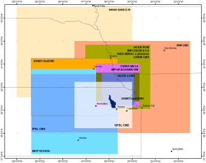 Impacts of climate change.
Climate change and associated anthropogenic shifts in weather patterns, land-use conditions, and extreme precipitation events significantly affect sustainability of current states of the watersheds. A framework for statistical downscaling of climate change scenarios produced by ensemble of Global Climate Models was developed by employing a stochastic weather generator WINDS and applied to assess hydrologic alterations in several watersheds in in Midwest. As another application, utilization of climate change scenarios in watershed management plans will improve the distribution of critical areas within a watershed and potentially lead to better watershed management in the future.
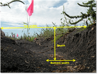 Water-quality assessment.
Non-point source pollution from agricultural fields, grazing lands, and urban areas are leading causes of water-quality problems in the United States. Sheet and rill erosion and stream bank erosion are primary sources of stream and lake sedimentation. Other sedimentation sources sources such as ephemeral and classical gully erosion are important but often overlooked. Work on geomorphological assessment of the concentrated flow pathway, width, length and headcut location of ephemeral and classical gullies is in progress with the use of GIS tools and statistical analysis of monitoring data. Studies of point and non-point sources of nutrients and sediment in numerous watersheds in Kansas have been conducted for state and federal funded projects.
Subsurface flows
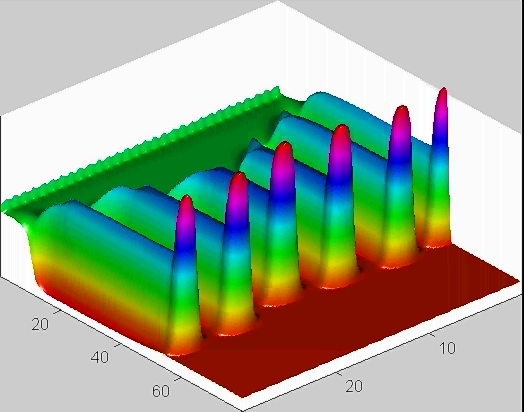 Preferential flows
Instability of unsaturated flows during infiltration or redistribution of water within the vadose zone has been identified to be one form of preferential flow through which fast transport of contaminants might reach ground water resources. Predictive phisical models need to be developed to describe such preferential flows. For gravity-driven unstable flows in unsaturated soils, several models were examined mathematically. The models included the conventional Richards equation, the Green-Ampt (sharp infiltration front) model, and the non-equilibrium relaxation model. Analytical analysis of one-dimensional flows and the numerical analysis of two-dimensional flows were conducted in attempt to mimic finger flows in vadose zones.
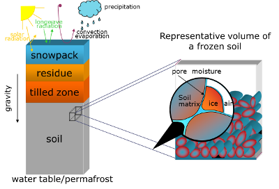 Freezing in soils
Understanding of freezing processes in soils in northern regions is significant because of their impact on hydrologic processes and energy balance at the soil surface. Whether freezing in soils is induced by natural weather conditions or by human activities, it's impact is profound. Several mathematical models were developed to study flows in unsaturated and saturated conditions.
Other research topics Other research studies include a study on processes in a snowpack, transport of sorbing contaminants with adsorption/desorption hysteresis in saturated soils.
Hydrologic Applications
 SWATioTools
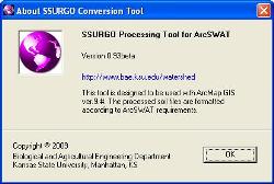
Modeling of watersheds with hydrologic modeling applications is known to be a tedious process especially dealing with pre- and post-processing of input and output data. To help with this process, a set of ArcGIS utilities (SWATioTools) was developed. SWATioTools were programmed with ArcObjects and Visual Basic and presented in a user friendly graphical interface as an extension to ArcGIS 9.x. One of key components includes the processing of SSURGO soils from a general tabular format to an ArcSWAT compatible database format. The resulting geospatial dataset is presented in a format of raster or shapefile.
 WATER
A continuous (15 minute time-step) simulation model, called Watershed Assessment Tool for Environmental Risk (WATER), was developed as a Windows application that allows practitioners to evaluate the risk of erosion and has a suitable framework to allow easier expansion to meet the future needs of the road construction industry. The model incorporates hydrologic, plant growth, erosion, and overland flow components, among others. The model is able to consider complex watersheds that include multiple land uses and a series of sediment control practices. The model is currently under development.
 WINDS
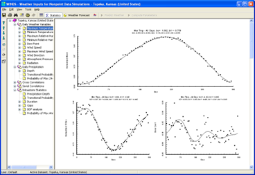
One of the key components of the WATER model deals with weather characteristics and rainfall patterns that are statistically generated based on available historical records for more than 200 locations in the United States. The weather/climate generator component called 'Weather Input for Nonpoint Data Simulations' (WINDS) is programmed as both integrated within WATER and independent stand-alone application. The WINDS weather generator has routines to determine statistical characteristics of daily climate variables and intra-storm characteristics from 15-minute precipitation data.
