Water-quality monitoring, modeling and assessment
Sedimentation in Kansas
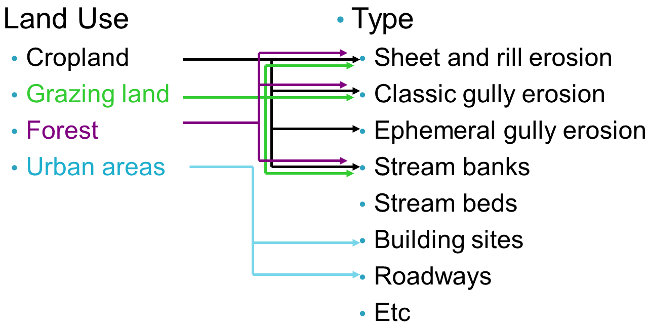
Erosion from agricultural, grazing land, urban, and wooded fields contribute to sedimentation problems in streams and lakes worldwide. Erosion chart showing sources and types of erosion:

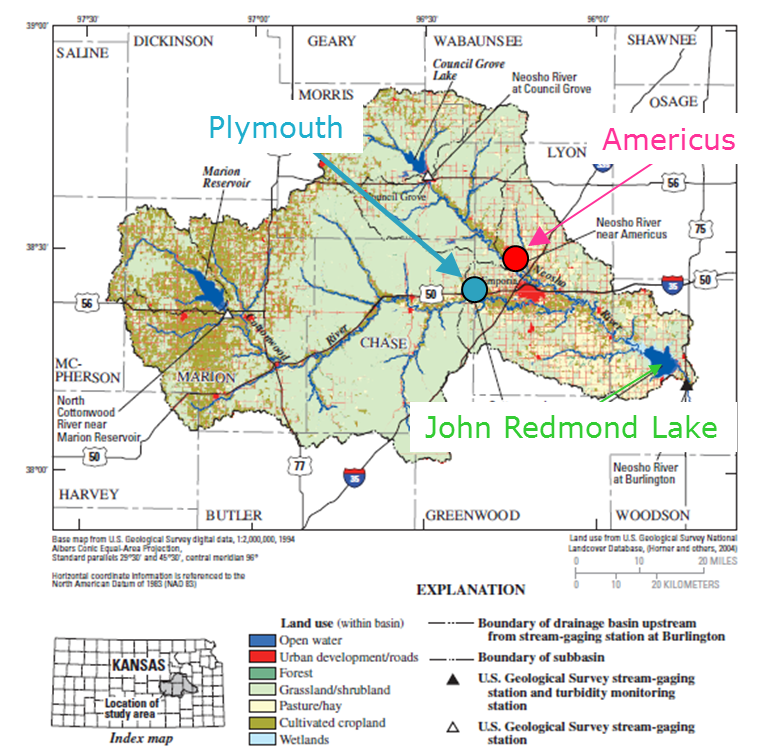
Impacts of different sediment sources on reservoir sediment storage capacity are studied in three HUC-8 watersheds (11070201, 11070202, 11070203) in eastcentral Kansas. The sediment contributing sources include overland erosion (sheet and rill erosion and gully erosion), streambank erosion, and bed channel erosion. Highly erodible segments of stream banks along Neosho and Cottonwood rivers and critical areas within subwatersheds. In this study we take advantage of available daily monitoring data on stream suspended sediment concentrations at two USGS stations and field survey data on approximate stream bank soil loss from 1992 to 2008 in more then 350 sites along mainstem of the rivers. Preliminary modeling results indicate extreme importance of bank erosion data on adequate representation of current conditions in the watersheds, and restoration and conservation efforts.

Ephemeral gully erosion
Ephemeral gullies are localized areas of soil erosion that form from concentrated water flow during hydrologic events. Ephemeral gullies generally form in cultivated soils during seedbed preparation, planting, and early crop establishment when the soils are bare, or have less vegetation or surface residue cover. EGs erode topsoil and often form in a similar location every year, may grow to classical gullies if not corrected by tillage often with less-productive subsoil, thus adding to producers' cost and management efforts. Erosion from ephemeral gullies in agricultural fields contributes a substantial fraction of annual upland sediment, and does so disproportionally (relative to other sources) during higher-flow events. Although the causes of the gully erosion were known, mechanisms related to ephemeral gully formation, location and geomorphological properties related to storm events, and amount of soil lost were not fully understood.

Geomorphological modeling of ephemeral gully development is a threshold phenomenon. The gully occurs only when a threshold has been exceeded. The threshold can be in terms of flow hydraulics, rainfall, topography, soil taxonomy, and land use and/or management. Several models were tested in watersheds in east-central and south-central Kansas to identify appropriate threshold values. The study on identification of gully locations, length, and other geometrical properties is underway.
Relevant publications:
- Douglas-Mankin, K.R., P. Daggupati, A.Y. Sheshukov, P. Barnes, D. Devlin, and N. Nelson (2011) Cheney Lake Watershed: Erosion from ephemeral gullies. Publication MF-3030. Kansas State University, Manhattan, KS.
- Daggupati. P., K.R. Douglas-Mankin, A.Y. Sheshukov, and P.L. Barnes (2010) Monitoring and Estimating Ephemeral Gully Erosion using Field Measurements and GIS, Proceedings of the 2010 ASABE Annual International Meeting, ASABE Paper No. 1009663, Pittsburgh, PA.
- Sheshukov A.Y., K. Douglas-Mankin, and S. Perkins (2010) Modeling of John Redmond Watershed with Soil and Water Assessment Tool (SWAT), Final Report, Part of John Redmond Dam and Reservoir, Kansas Watershed Feasibility Study, Kansas Water Office, Topeka, KS.
